
Without a doubt, the coast of Louisiana is disappearing at an alarming rate. Something has to be done — and quickly — to stop our shorelines from sinking into the Gulf. But are diversions the answer? More and more scientists are now looking at the Mississippi River not as a solution, but as part of the problem.
Why are some of the highest erosion rates occurring where the river has the most influence on the marsh?
The State’s Coastal Protection and Restoration Authority claims it used the best science available in forming its 2012 Master Plan, but some science was ignored and is still being ignored. The authority’s plan features what it calls “sediment” diversions. These are controlled levee breaches that will introduce massive amounts of nutrient-rich freshwater into brackish marsh areas — four on the East Bank and four on the West Bank, two of which will have the capacity of 250,000 cubic feet of muddy water per second. (To put that into perspective, 250,000 cubic feet of water pass through the Bonnet Carré Spillway when the river is at flood stage and the spillway is fully opened into Lake Pontchartrain.)
Garret Graves, head of the coastal authority, often says, “We have to reconnect the river to the land because that is how the delta was formed.” Yes, but it took a millennium for the Mississippi River to build its delta, and we don’t have a thousand years. Moreover, the Mississippi is now a very different river than it was even a century ago. For one thing, it carries only a quarter of the sediment. For another, it’s loaded with chemicals, fertilizers, and pollutants, making it far less friendly to the environment.
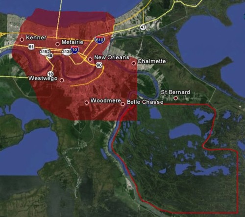
For purposes of discussion, let’s focus on just one of the diversion projects, the proposed diversion at Braithwaite, near the St. Bernard/Plaquemines parish line.
A freshwater diversion has been operating in the area since 1992: the Caernarvon Diversion, with a capacity of 8,000 cubic feet per second. According to the coastal authority, it was not meant to be a “sediment” diversion; it was designed to deliver 8,000 cubic feet per second of river water into a brackish water marsh. And, for 17 years, at peak river levels, that’s what it did.
Then, on August 29, 2005, Hurricane Katrina drove a 27-foot storm surge ashore. Overnight, 42 square miles of marshland were gone! Astoundingly, 37 of those 42 square miles were near the Caernarvon Diversion. Add in additional losses from Hurricane Gustav, three years after Katrina, and the total is stunning, the equivalent of a rectangle 14 miles by 17 miles. That’s the distance from the middle of Lake Pontchartrain to the Huey Long Bridge on one side, and on the other from Louis Armstrong New Orleans International Airport to the Lower 9th Ward.
Throngs of scientists from various universities have studied this phenomenon. The key question: Why was the erosion rate near the diversion the highest ever recorded?
What they found was that the high levels of nitrates and fertilizers in the diverted water had transformed the stronger, brackish water vegetation into freshwater vegetation with shallow root systems. Instead of providing the much-touted buffer against storm surge, the whole marsh was peeled up like a carpet!
Here’s the bad news as summarized by the National Academy of Sciences in their study, “Hurricane-induced failure of low-salinity wetlands“:
The dramatic difference in resiliency of fresh versus more saline marshes suggests that the introduction of freshwater to marshes as part of restoration efforts may therefore weaken existing wetlands rendering them vulnerable to hurricanes.
We should not be surprised by the ill effects of river-borne nitrates. After all, they’re the same culprits that cause the “dead zone” in the Gulf of Mexico every summer, a 7,000 square-mile swath of water so depleted of oxygen that marine life can’t survive in it.
The Coastal Protection and Restoration Authority argues that some of the studies showing that fertilizer pollution weakens marsh and waterway embankments were done on the East Coast, an area with wider — nine foot — tidal ranges. Well, we may not have nine-foot tides, but that the same phenomenon has happened in our area is undisputed fact. Satellite images of the area near Caernarvon show that during Katrina it sustained erosion rates 10 times greater than the higher-salinity Biloxi Marsh — and Hurricane Gustav offered further evidence of the Caernarvon area’s vulnerability to erosion. (For related research, click here.)
The Breton Sound estuary, directly in the path of the Braithwaite and Caernarvon diversions, is one of the most important estuaries in the United States. It is classified by the U.S. Fish and Wildlife Service as an “essential fish habitat.” And yet the planned diversion will transform the marsh into a freshwater environment, driving out the juvenile stages of all saltwater finfish species for the simple reason that they need salinity to survive. A $3 billion-a-year commercial and recreational fishing industry will be threatened. So too, the shrimp and oyster harvests.
Yes, these diversions will cause an enormous disruption to the lives and livelihoods of families who have fished, trawled, and dredged these areas for generations. Add in what we’re beginning to learn about the marsh-destroying power of nitrates and chemicals, and it’s harder and harder to think of the Mississippi River as a “friend” to those of us striving to save Louisiana’s coast.
Captain George Ricks owns and operates Get-Away Fishing Charters and is the president of the Save Louisiana Coalition.

