
A basic contradiction in New Orleans’ post-Katrina response to the flood threat shadows every aspect of our recovery. As anyone knows who has taken a close look at my house in the Lake Vista neighborhood, I’ve tried to capture that contradiction visually.
On the one hand the city’s Master Plan encourages residents and, presumably, elected officials to “advocate for a minimum 500-year flood-protection level” and to “adapt building regulations to respond to hazard risks.”
But the long-simmering draft of the city’s Comprehensive Zoning Ordinance takes its cue from the much lower Base Flood Elevations set by FEMA and used to establish flood insurance rates. Having embraced that low standard, the zoning ordinance spills a lot of ink urging zoners and residents not to deviate from one another as they rebuild residential neighborhoods. The document warns against “disruption” of a neighborhood’s visual integrity if houses are elevated to different levels.
Our efforts to avoid “disruption” of neighborhood optics seem to be less than persuasive to FEMA’s Community Rating System, the rankings on which flood insurance rates are set. On the CRS 10-point scale, we continue to rank a dismal 8. (Jefferson Parish, as a point of reference, is at 6.)
Underlying this conflicted approach to residential safety and neighborhood resilience is a wildly contradictory collision of science and politics. Politics, if it looks to anything beyond short-term opportunism, takes refuge in a statistical average of past events. Sure, we get the occasional Katrina, but on average hurricane impacts are less catastrophic. Hard-headed science, by contrast, meditates more soberly on worst-case scenarios — those “black swan” events that make a mockery of our expectations (or of our levee systems, as Katrina did, or of the global economy, as happened in 1929 and almost happened in the 2008-9 crash.)
Unfortunately, our Hazard Mitigation Plan, like the National Flood Insurance Program, builds on statistical averages.
My concern is that these same standards rooted as they are in a willful ignorance of science, hasten New Orleans’ destruction once again.
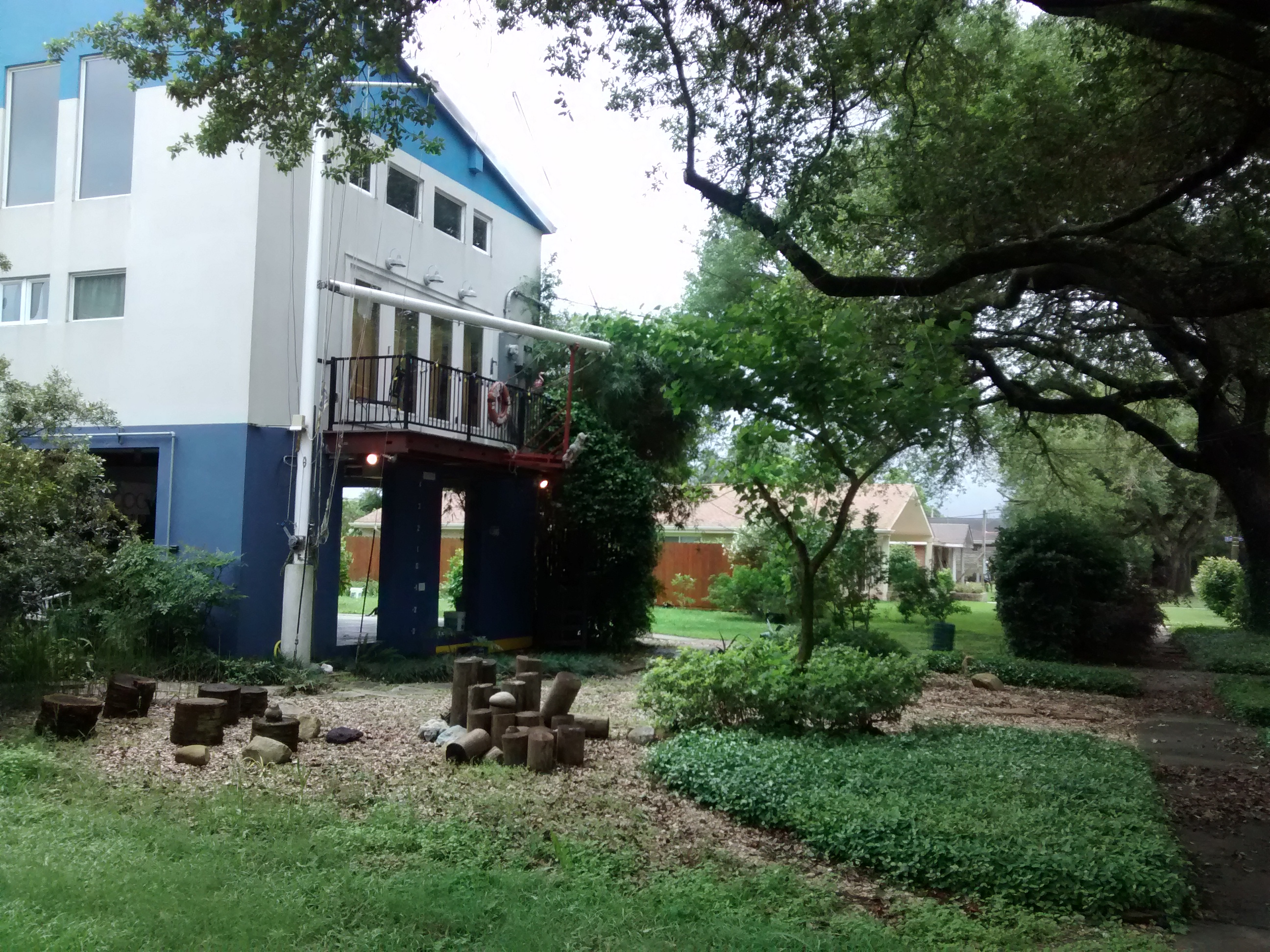
I’ve tried to capture the difference by marking the base of my now well-elevated house as though it were the hull of a ship. On the uprights below the sky-high ground floor, I have created a scale of 1-foot increments. On that scale I’ve marked the current Base Flood Elevation (BFE) at 4 feet, the Mean Sea Level (MSL) at 5 feet and the Katrina High Water (9 feet). I’m the only one in our neighborhood of over 250 properties to have done this, but it’s my contribution to spreading flood awareness and Katrina remembrance.
Bounded by Robert E. Lee Boulevard, Paris and Filmore avenues and the London Avenue Canal, Vista Park’s flood risk was extreme before Katrina and remains high in this and other neighborhoods near the lake even after levee improvements.
Before Katrina, it was a prime example of a 1950s housing development that never should have been permitted. Today, a quick tour of our cracked and continuously subsiding streets reveals a striking disregard for the CZO’s exhortation to avoid disruptively inconsistent elevation levels. Some renovated homes remain slab-on-grade structures — the type that abounded near the lake and all across New Orleans East before Katrina. Others — mine among them — are at elevations that would not look out of place in a cluster of beach houses or fishing camps.
New homes in Lake Vista are being built to the flood insurance program’s 4-foot minimum elevation, notwithstanding that Katrina’s floodwaters surged to 9 feet. Efforts to create a safety-oriented covenant that would have required higher elevations for rebuilding went nowhere even though they would have led to reduced flood insurance rates.
The standoff between those who subscribe to statistical averages and those — like me — who dwell on worst-case scenarios may result in a lack of visual conformity. But the Vista Park community is far more cohesive and engaged than we were before Katrina. Different elevations seem to have had no discernible effect. Indeed, as unavoidable reminders of the post-Katrina struggle to recover, they may be a net positive.
Nonetheless, as a retired systems engineer, I yearn for some form of authoritative citation that encourages a sharper awareness of the actual risks we run living in a place like New Orleans.
FEMA has created a flood-risk communication initiative called Mark the Line that encourages communities to prominently mark their historically highest flood level.
For New Orleans that could mean retracing and preserving our Katrina “coffee stains” — most of which have faded away or been painted over. The elevation markers are my contribution to that conversation. My coffee stains would have to be painted in the air below my now lofty first floor.
The politics of flood denial are one of the most powerful political and economic forces this city has ever known and are likely to institutionalize greater flood risk for the foreseeable future. Reading the propaganda of the affordable flood insurance “movement,” which is based on crass science denial, convinces me that safety will never come first. This is despite our being named and funded in the first tranche of the Rockefeller Foundation’s global Resilient Cities Network.
Proponents of lax flood elevation standards were concerned, of course, that too stringent standards would retard recovery. My concern is that these same standards rooted as they are in a willful ignorance of science, hasten New Orleans’ destruction once again.
Lake Vista resident K.C. King retired after 40 years as a systems analyst with Boeing.

